Asbestos Contamination Expected to Delay Wildfire Cleanup

Asbestos testing with certified asbestos consultants and other experts has been ongoing since 2 wildfires – the Eaton and Palisades fires – blazed across California in January 2025. More properties that burned in the Eaton fire in Altadena, California, have now tested positive for asbestos, according to Senator Adam Schiff.
The U.S. Army Corps of Engineers reports about 50% of the properties damaged in the Eaton Fire have tested positive for asbestos. About 33% of properties burned in the Palisades Fire also tested positive for the toxic mineral that causes mesothelioma, ovarian cancer and lung cancer.
As of March 8, 2025, the USACE says 2,269 properties have been completely cleared of hazardous material. Crews have been carrying out asbestos abatement by hand before larger-scale debris removal efforts begin. Schiff says finding more asbestos nearby may change the cleanup timeline.
“There are a higher number of homes here in the Eaton Fire burn scar than in the Palisades, apparently, that have asbestos,” Schiff told reporters in Altadena on March 20. “So that affects the cleanup times.”
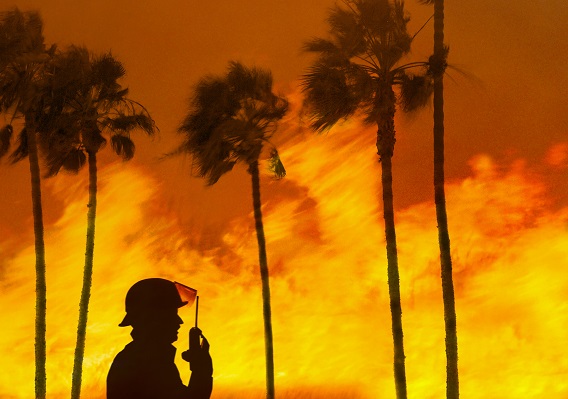
In total, California fire officials say at least 29 people were killed, more than 16,000 structures were destroyed and more than 37,000 acres burned. While concerns were raised about the latest test results’ impact on the cleanup timeline, the governor’s office officially announced “The cleanup following the Los Angeles fires is on track to be the fastest in American history…”
Asbestos Warnings and New Maps Identify Future Fire Risks
In February 2025, the Los Angeles County Department of Public Health warned residents, saying all homes within 250 yards of the wildfires’ burn sites are at risk of asbestos exposure, hazardous chemicals and heavy metals like lead. In January 2025, Altadena deputies were warned about the need to wear N95 masks to avoid inhaling airborne toxins like asbestos and lead.
According to newly released fire hazard maps, nearly 4 million Californians in the Los Angeles area are now in hazardous zones. The new maps created with field-tested models assign a hazard score based on fire likelihood and fire behavior. Other factors considered are blowing embers, existing and potential natural vegetation to fuel fires, predicted flame length, terrain, typical fire weather and wildfire history.
New fire hazard maps require newly built homes in hazardous areas to meet heightened fire-resistant building standards. Subdivisions must also be carefully designed to include adequate water supplies, built-in fuel breaks and several evacuation routes.
Legacy asbestos remains in an estimated 73% of structures in Southern California, according to the California Department of Forestry and Fire Protection. Asbestos in homes, schools, businesses and industrial buildings was common before asbestos building materials were phased out in the 1980s.
Fires that burn these older structures can quickly spread the carcinogenic material into the air miles from the source. Some California lawmakers are making a push to keep a closer eye on environmental toxins to avoid public health threats like asbestos exposure.
Lawmakers Call for Federal Action
Nearly a dozen California lawmakers in the Los Angeles area are asking the federal government to create a joint task force to monitor harmful pollutants the recent wildfires released into the environment. They say routine smog and air quality monitoring systems don’t check for potentially harmful impurities like asbestos, lead, chlorine, ash and other metals.
Members of Congress sent a letter to the administrator of the U.S. Environmental Protection Agency, urging the agency to assemble a task force. The proposed group would track all potential hazardous air, water and soil pollutants, regularly reporting its findings to the public.
The letter states: “Despite the fires, recent Air Quality Index levels in greater Los Angeles have ranged from ‘Good’ to ‘Moderate’ even with the threat of things like asbestos or lead in the air, because AQI does not measure all potential airborne wildfire-related pollutants. Residents are, therefore, unsure of the actual risks they face and confused by conflicting reports about how safe it is to breathe the air outside, which may lead to families not taking adequate protective measures.”
It continues: “This lack of full information could increase the risk of long-term negative health effects, especially among vulnerable populations like children, pregnant women and the elderly, regardless of whether or not people are in areas that have been directly impacted by wildfires.”